
Trailess backpacking in isolated parts of the park, May is the driest month in Alaska, plenty of possibilities in vicinity of Anchorage, easy and inexpensive transport from Anchorage (by bus), no need to take a plane. Near 24h of sunlight.
This is our summary budget as of May 2003 (we arrived in the
afternoon to Anchorage, it is possible to reshuffle places and times, in my
opinion there is no fun to stay in Denali NP campgrounds: no free showers there!)
flight Boston - Anchorage (480$+)
shopping, fuel (open 10am-9pm) 1 night hostel Anchorage (16$)
return ticket to Denali (109$)
1-2 night camping park HQ (Riley Creek Campground 12$; time to book sectors;
entrance 5$, bus maxi 16$)
1 night camping park HQ (12$; we take our food; showers in McKinley
Mercantile convenience 3$!)
3 nights state park (or other part of the park; less hard work)
1 night hostel Anchorage (16$)
1 night hostel Anchorage (16$)
TOTAL 685$ + food + airport cab etc
The
McKinley airport webcam
Hostels in Anchorage
$17/person @ Spenard Hostel (3 km from the airport, cap 8$)
15$/night(?) camping (not so
bad since it is near some trails, showers 2$)
15$/person (10$/person in tent) here,
they seem to provide some kind of pickup at the airport)
23$/person HI-Anchorage (downtown, checkin 8am-12 5pm-1am, cab 18$)
$25/person here
$12/person hostel in Girdwood (might be useful for doing the Bird Ridge and/or
Crow Creek trail); there is also a camping 5$
Anch-Denali Shuttle
May 11 - Sept 25
Dep 7:30am Arr 1:45pm
May 25 - Sept 11
Depart Anchorage International Hostel (Corner of 7th Ave. & "H"
St.) 3:00 pm Denali National Park (Visitors Center) 8:15 pm
RETURN
May 24-Sept 10
dep 7:15 am arr 1:30 pm
May 10-Sept 24
dep 12:30pm arr 6:30pm
Denali
park Shuttle Bus
May 24 - September 11
Buses to Eielson: June 1
Buses to Wonder Lake: June 8
Page of polish bikers about the park (in polish).
Main backcountry information are here. Some distances in the park are here. Some your questions may find answers on the Park's chat page. Here is a detailed story about a short hike in Denali; he says that it is good to buy supplies in Anchorage before coming to the area, there is also a gear list but it seem to be overkill for what he did (seems to be a gear person ;), I like his resume of the gear: Total Weight: Very Heavy :)
Denali State
Park
The Kesugi ridge trail starts at Trublesome Creek, ends at
Little Coal Creek, and the Park Headquarters (Byers Lake) are in the middle.
They also loan out bear canisters, for free (you have to leave a driver's license).
At Veterans Memorial Station, near Byers Lake. Some info and photos.
Chugach
State Park (near Anchorage)
I also spotted a nice 3-4 day ridge trail (for change from
valley trails in Denali) near Anchorage, it is described and maped here,
we can go there by hitchhiking 30km
or eventually try to talk with this bus
operator to Seward. Some info also at REI:Anchorage
page.
We (me, Justine and David) arrived to Denali NP on 25th May 2003.
We hiked:
the South Side of the Alaska Range (13 days/approx.180km) from the Park HQ to Eielson Visitor Center,
Wyoming Hills (4 days) and
the approach to the Polychrome Glacier (2 days).
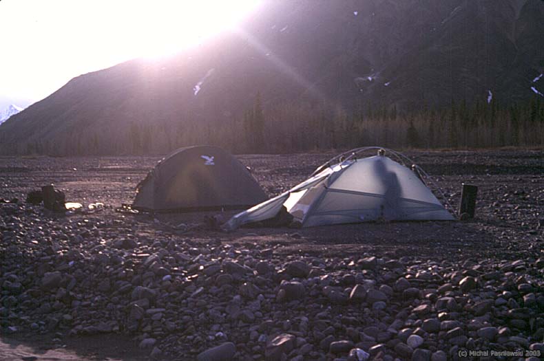
Between the South Side and Wyoming Hills and after the Polychrome Glacier hike we spend nights at the Riley Creek campground (showers, some food, and lot of RV!).
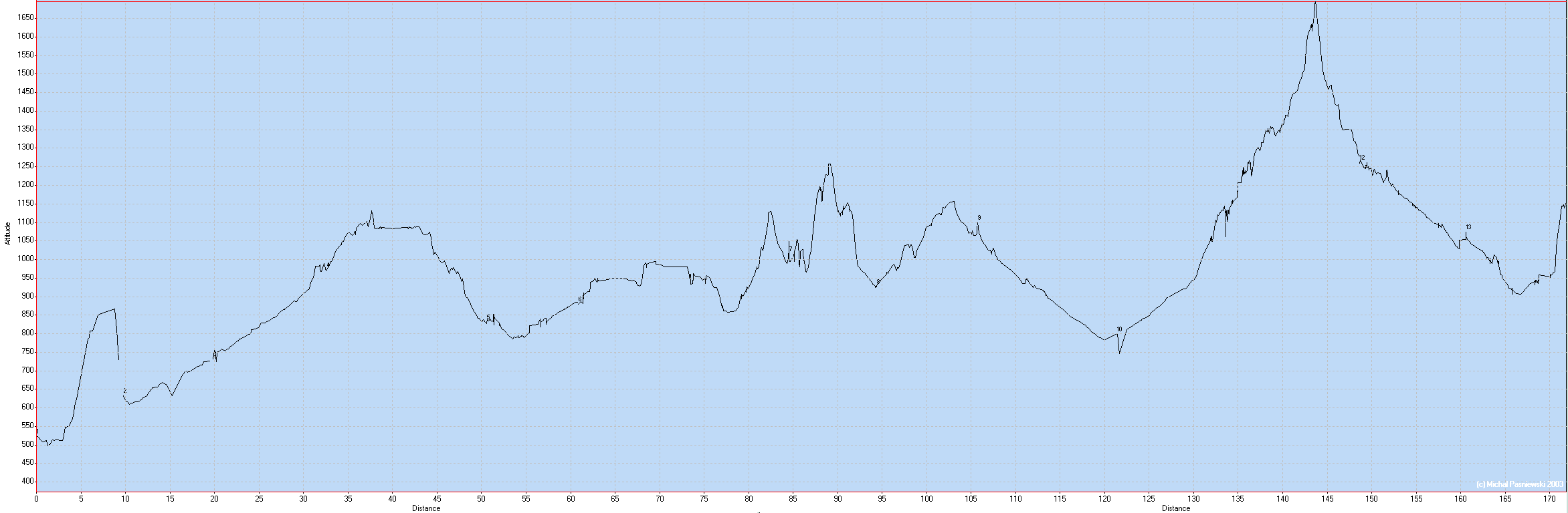
Profile of our route on the South Side of the Alaska Range (numbers indicate starting days)
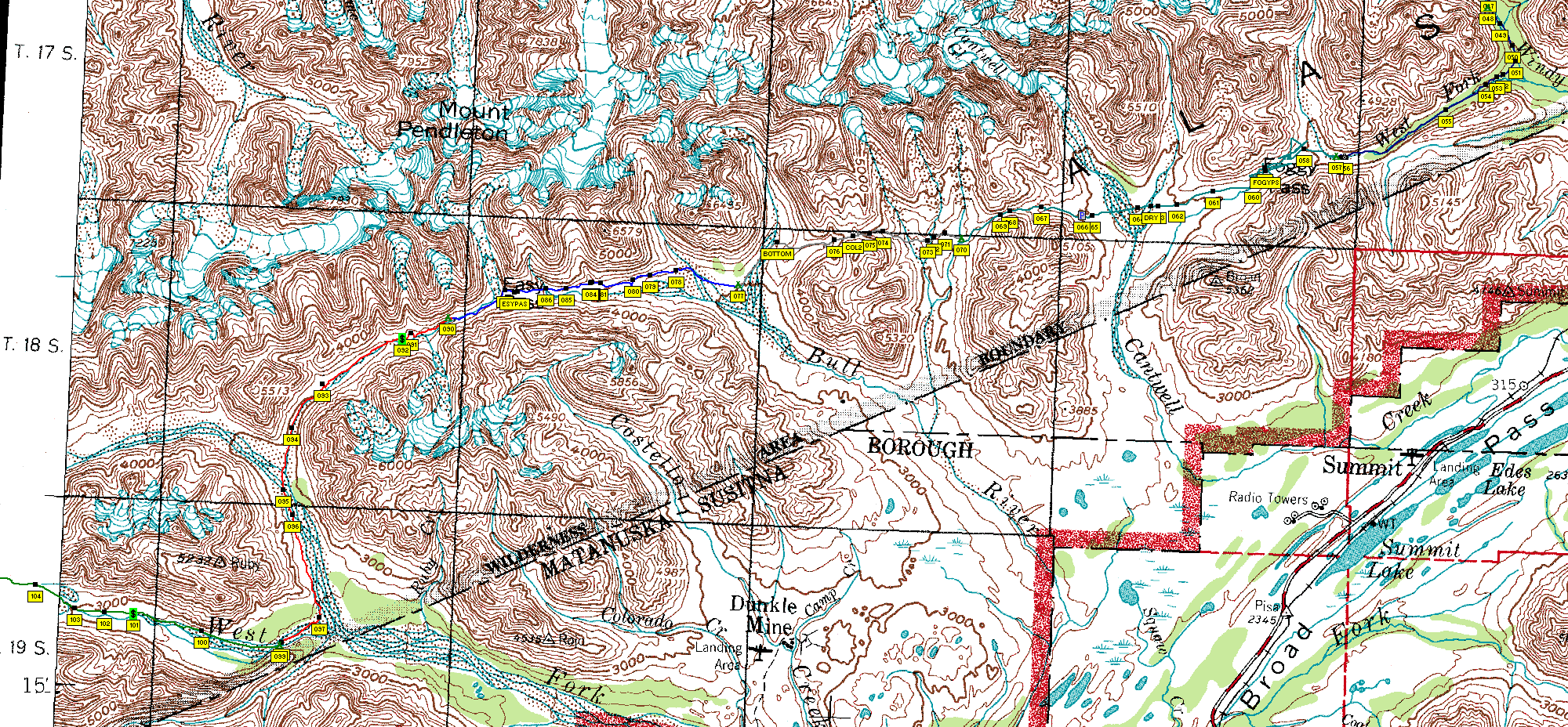
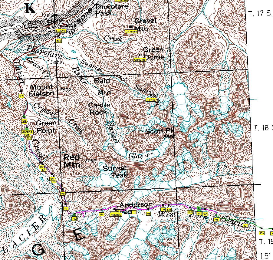
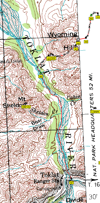
Our trip maps with the track and camps (small green tents, other symbols mean "good" tent sites):
Map of South Side days 1-4 [png format, 400kb]
Map of South Side days 5-9 [png format, 660kb]
Map of South Side days 10-13 [png format, 290kb]
Map of Wyoming Hills days 1-3 [png format, 170kb]
Map of Wyoming Hills days 4-5 [png format, 130kb]
Scale for all maps above
My GPS data:
Ozi Explorer waypoints and tracks [wpt and trk files in .zip]
Garmin Mapsource tracks [version 4.09, .mps file in .zip]
Here is a good source of DRG (Digital Raster Graphics) topo maps for Alaska. Here are other maps, including DLG (Digital Line Graphics).
The land cover map of the park can be find here but it is in ARC/Info format. I have converted it to a 4Mb PNG image with its Ozi Explorer .map calibration file.
Remarque: in our backpacking history, we had never had such holidays as in Alaska this year: only one day of bad weather (rain+wind) for 3 weeks of trekking, otherwise sunshine and temperatures above 20C !
Here is my slideshow featuring 143 photos (about 1h of viewing)
If your resolution is 1024x768 or less go here
, otherwise go here
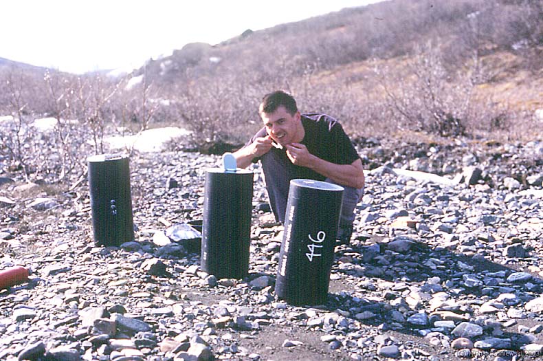
Our life-support system included the bear-proof containers
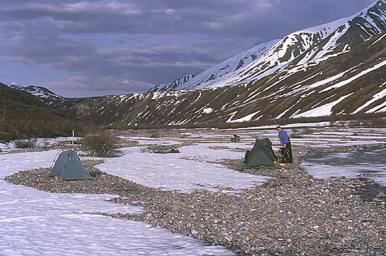
. Usually we camped on patches of grass or gravel near nearly frozed streams
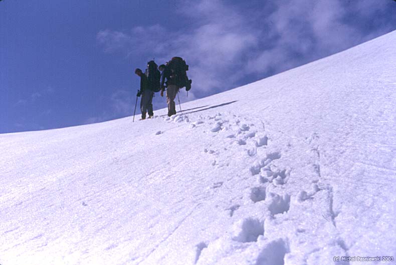
. We advanced rather slowly, 15km per day. Looking at this you see why
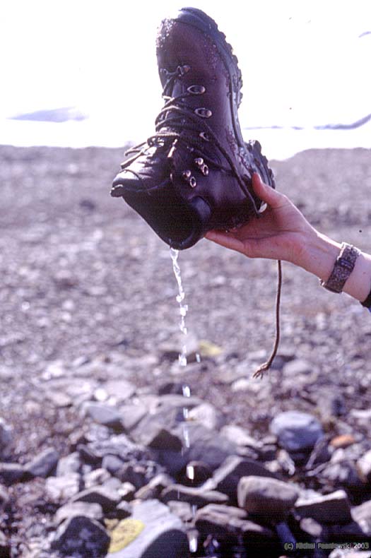
. But when snow was hard the only problem was wet shoes
. We walked in near-silence and appreciated the views, here on the Mount Pendlton
. In some places it was faster to hike in the glacier streambed... or rather in the stream with obvious results
. This is our worst camping, we called it The Elevator because of the 15% slope
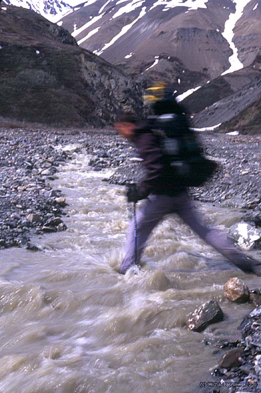
. Stream crossing was usually as simple as jumping (the 2002/03 winter was one of the driest from 10 years or so)
or as difficult as slow advancing in a fast muddy glacial stream on stones rolling on the bottom
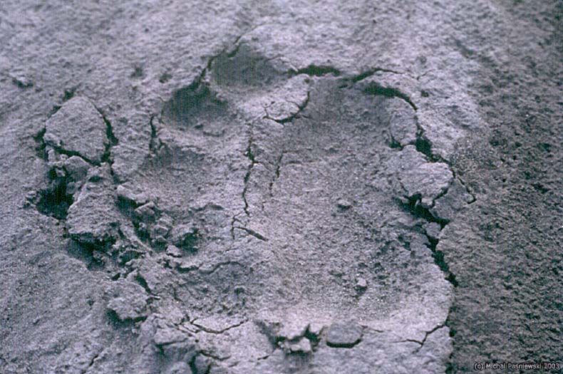
. Although on the South Side we didn't meet any bears we still could find the prints
. This is our last camping before engaging on the Wast Fork Glacier morene
. Here is how it is walking in the middle of the morene
- very tiring and sometimes dangerous because of the ice under the lyer of stones. We camped on the morene
just before entering the snowfield of the glacier
. A bear-mountaineer left this trail for us
. This is a spectacular tunel made by water melting from the glacier
. It is 4pm and we climb steeply on the Anderson Pass
. There is a striking contrast between the south and the north side of the Alaska Range, the last is much less snow-covered and more dry;
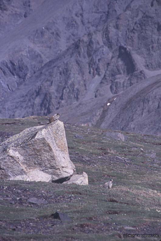
this is a family of gophers lying in the sun . The Glacier Creek was nearly dry
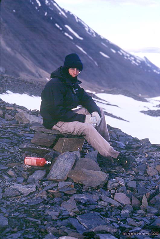
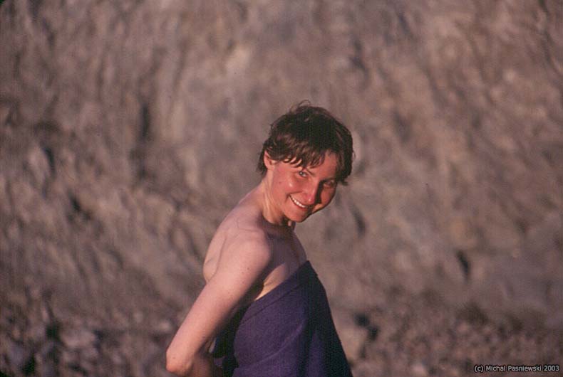
. Our evening shower
in sunset
. When the camp was up and Dave already sleeping, we climbed on the morene
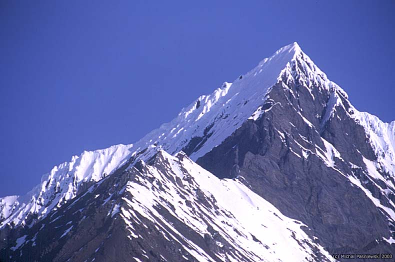
where we could appreciate the closest view on the Mount Denali
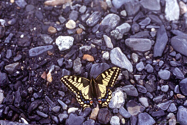
. As we descended we were founding first signs of the civilization and first butterflys
. Siesta on the top
. The dream team on a frozen stream (wearing crampons)
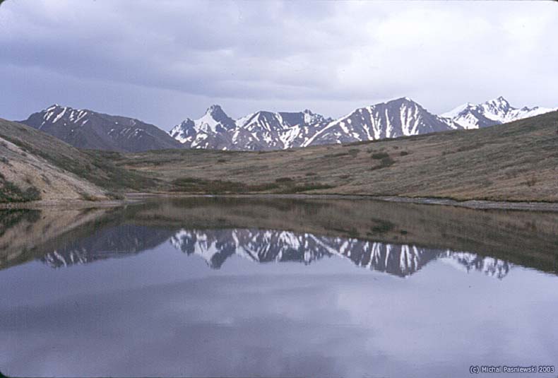
. Camping on a still small lake
.
More photos are also on the Dave website.


