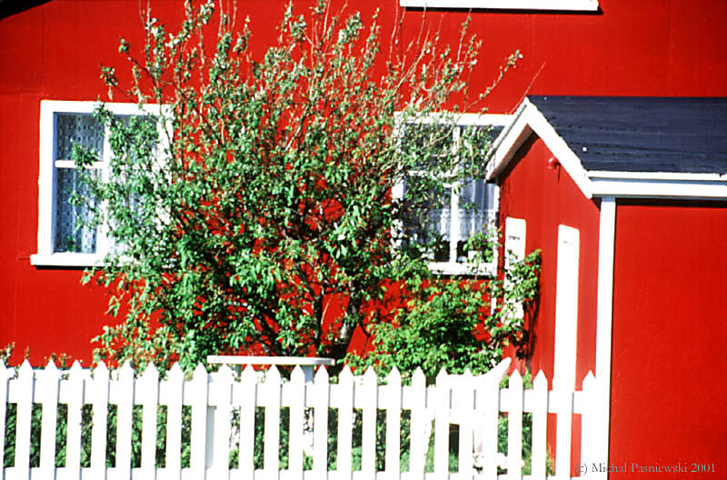
Day 1
From Paris to Akureyri
![]()
The flight is with Icelandair discounted tickets. Each bike bag weights more than 20 kg but we do not pay for overweight. As we approach the island the sky gets clearer and we can see the glacier!!! Well, next time we'll take the places on the right.... We are waiting quite long for our bikes but they arrive at last and we catch a flybus to Reykjavik. It arrives at a hotel but we need to get to the BSI bus terminal, so we quickly take a taxi (600IKR) and we are in a bus going to Akureyri just 5min before the departure (17:30)! We're in Akureyri at 23:20 and the driver is very kind leaving us at the camping site - well it's not far from the bus stop (before the Tourist Information Office) - but it's 100m higher and our bikes are still in bags! The camping is big and there isn't a lot of tents or cars: the 20th of June is just a beginning of the season. That was a very long day.... [Now, we know that there's a bus from Reykjavik to Akureyri going through the inland desert, more tiresome journey but more interesting]
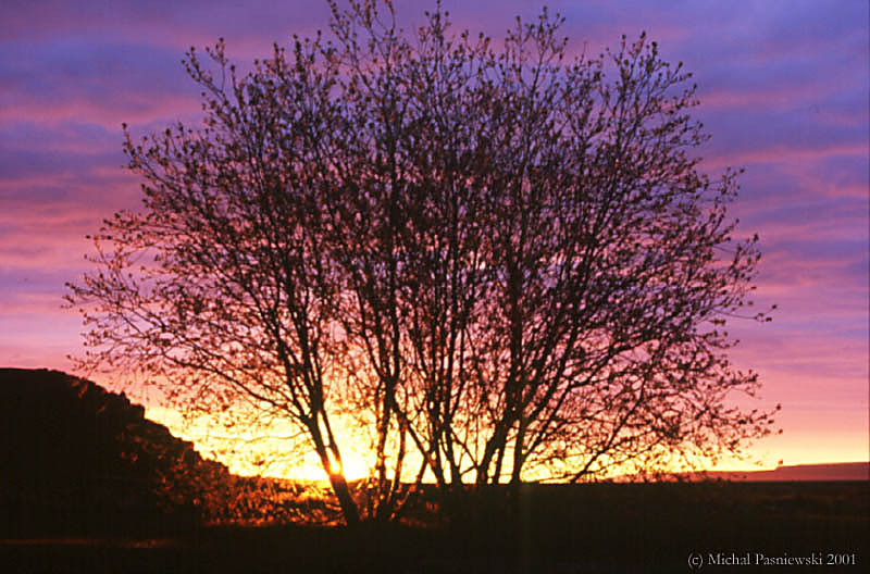
Day 2
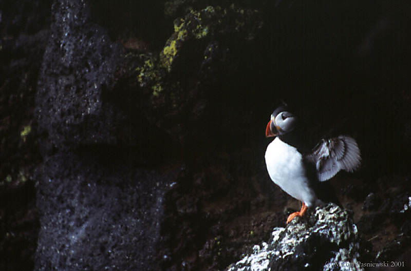
From Akureyri to Asbyrgi
![]()
The road (85) along the west coast is not so interesting but the east cliff is very nice and we find some puffins but too far to make good photos.
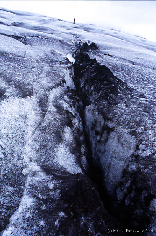
As we approach the Asbyrgi camping we notice impressive fissures in the ground, and the camping is in a canyon, between two of them.
This camping is the best we will see in Iceland: 500IKR per person, free dryer, 100IKR for a hot shower, bread, milk and cookies to buy, lovely setting, nice warden, silence, what do you need more? We are the first Polish people this year.
That's the 21st Jun so it's a longest day here (my GPS says the same: no sunset no sunrise! We're 30 km from the Arctic Circle. In Reykjavik we heard that people roll naked on the grass but here it cannot be quieter.... I made some photos of the midnight sun.

Day 3
Biking in Jökulsargljufur National Park
![]()
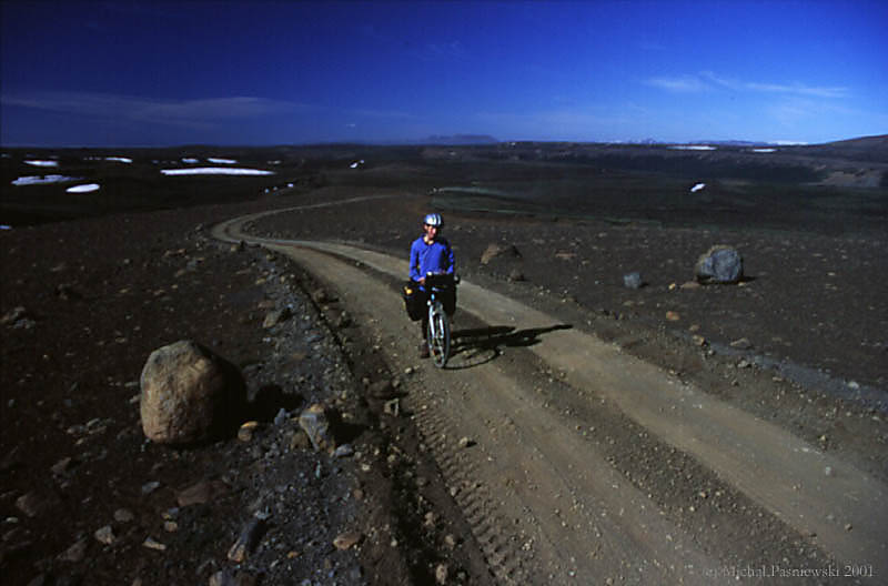
Day 4
F862 once again
![]()
From this point the road is getting worse for cars (it is prohibited to not 4WD) but better for bikes, there is no more "wash-board" like surface! We are riding through a Martian or moonlike landscape until it gets too cold - it is about midnight that we set a camp. We have just enough water to cook Chinese noodles....

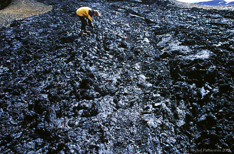
Day 5
F862 once again (2nd day) and Myvatn
![]()
We're on the camping at noon and there's a well-equipped shop ("supermarket") where we buy fresh things. We camp (500IKR), eat, and take a shower (100IKR). At the reception we learn that the Askja road is still closed.... The camping has a tent with cooking facilities (the only camping like this we've seen in Iceland), even a big pot ideal for making spaghettis. But after a long time of synthetic meals we prefer 10 scrambled eggs on bacon.
We spend the afternoon visiting the Myvatn lake surroundings: first we went on bikes to Grjotagja fissure where we hope to take a hot bath but water is too hot, 60°C. Then we continue on a road and then we must walk with our bikes through 2km lava rubble along a fence. We flat our tires to climb Hverfell crater (the surface is volcanic sand) but it is too steep, but once on the edge the path is rideable so we make a round trip (the crater is 1040m diameter). I downhill from the crater but Justine dare not.
This evening it'll be a killing 250g of spaghetti per person (with tomato sauce and Gouda cheese).
Day 6
Krafla and Dimmuborgir
![]()
The view from the road is rather industrial: a geothermal power plant that takes the entire valley. We continue along the pipes and climb to the parking lot where we take a tourist path,
Like all tourists we visit a fresh lava field with geothermal "features" like boiling water lakes and lot of steam. The lava is very impressive. Then we continue along the main road to the Viki Crater Lake, which has very nice colors.
The road back to Myvatn is much easier but monotonous except the 10% hill....
After a meal we take a road round the lake to the lava field called Dimmuborgir. When we arrive there at 9PM, we leave bikes at the entrance and visit for about an hour. There is nobody except us (we read in the guide that average 1000 people per day visit this spot...). The features are enormous; there are some caves and the field looks very nice in "sunset" light.

Day 7
All day bus ride to Höfn
![]()
Just before taking a bus, we make a short ride to the bird reserve (I think the bird reserves in Poland are much nicer...).
The bus to Egilsstađir (at 10:30) goes across a stone desert. I am skeptical about doing this part on bikes: there is nothing during something like 150km, except the road, bridges, electricity grid, and the landscape changes so slowly.
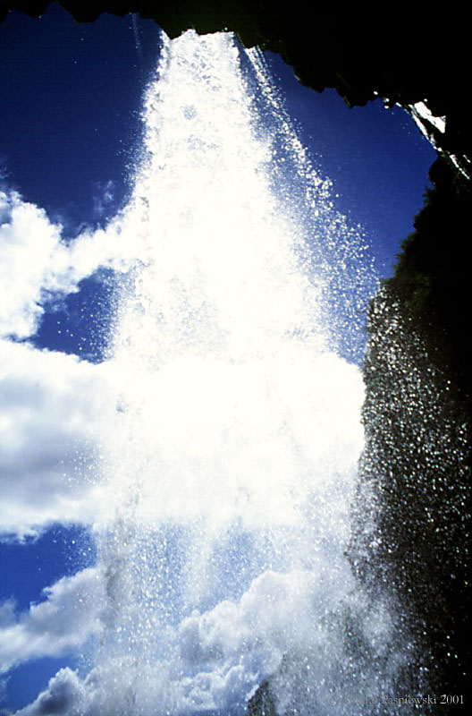
Just before Egilsstađir there is a very nice canyon and lots of waterfalls on both sides of the road.
Our bikes arrive with no problem (they were attached at the back of the bus, on steel "corns"). We change money and eat launch (there is a really big supermarket just by the bus stop that is in front of the camping).
The next bus driver is faster (maybe retired Formula 1 driver?). The weather is getting worse and worse, it's normal - we are going to the south of Iceland! Just before Höfn we stop on a saddle with fantastic view on "sundur" (sand fields by the sea).

Day 8
Höfn to Skaftafell (1)
![]()
That's our first day on the south coast: we have light back wind and nice sun! The road is very... straight! The part just after Höfn goes through bird reserves.
In the evening we stop by Jokulsarlon glacier, where one can see the glacier falling into pieces melting and floating to the sea. Here we leave our bikes and make a 3 hour walk to the glacier (but we do not reach it). An enormous sea hawk attacks us as we try to approach its nest - we are really impressed!
We continue on the Ring Road but tired we stop at 11PM and camp by the road.
Day 9
Höfn to Skaftafell (2)
![]()
Day 10
Skaftafell
![]()
In the afternoon it gets nicer so we decide to hike around Skaftafellsheiđi mountain. We make some nice shots of Svertifoss (really worth seeing) and go Svarthamragil, a small lake in front of glacier. Here we cross Morsardalur river and continue in beautiful valley of Kjos (we think it's one of the nicest spots in Iceland!). I am very unhappy because the sun is just in front of us so we cannot really appreciate the colors of rocks... Remember to go there as early as possible!!! It is very late when we decide to return, and we're running out of fuel (light sandwich lunch only...) so the way back we nearly run: the guide states 10-12h for a trip - we did it in 8h (with long photo sessions)!
Day 11
Skaftafell (2)
![]()
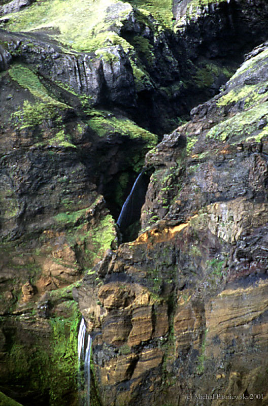
In the evening I am not tired enough so I take my MTB and make an excellent ride to Svertifoss and than to Sjonarnipa. This time the view from the point is excellent; you can see the glacier cut into a mosaic by fissures.

Day 12
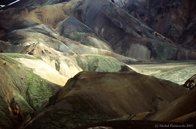
Landmannalaugar
![]()
The road to Landmannalaugar is very hilly. Sometimes we do not see the road on "blind summits"! The bus stops at Elgja valley but we only see some sheep and that's all. Then the road goes very often across rivers (it might be up to 40cm in deepest places).
At noon we arrive at the camping-hut. The atmosphere in the hut is not very "mountain hut"; there are a lot of people. As usual we meet the same German couple (remainder: we've already met them in the first bus...): I suggest a photo together :-)
It's still raining, however we make a short walk to Ljotipollur Crater Lake. The track is very bad marked so it is better to follow the road. With a national park map and my GPS we find the lake, which has nice red slopes. By good weather this track is feasible on MTB.
In the evening we relax in the hot (rather: warm) stream just by the hut.
Day 13
Landmannalaugar to ţorsmörk Trek (1)
![]()
Day 14
Landmannalaugar to ţorsmörk Trek (2)
![]()

Day 15
Landmannalaugar to ţorsmörk Trek (3)
![]()
Here we can buy some sweet wafers with lots of jam and a glacier of whipped cream :-) (we are running low on calories because we have lost our Snickers and chocolate bag the very first day of the track...)
First we think about taking the 15:30 bus to Reykjavik but after a short reflection and careful reading of the guide we find a better solution: we are 4 so we can charter a small airplane to Heimaey Island (Vestmannaejar)!!! The warden calls the company and it is ok, they will fetch us from a near airstrip tommorow at 9AM! Moreover it is cheaper than going to ţorlakshöfn and taking a ferry (300IKR/person)! Excited with this arrangement we visit the Ţorsmörk area. It is not as nice as we thought it would be but there are good views on sand fields and a glacier (from a Valahnukur hill with view disk).
Day 16
Going to Heimaey!
![]()
The flight is short (abouth 20min) but views are fabulous, even with rather bad weather.
The airport is in the middle of the island. From there we go by foot to the village, which is in our view the nicest one in Iceland. Here we separate: the Germans go to the camping, we go looking for a sleeping bag accommodation. First we enter the "hostel", a quite sad place... Than we try Skolavegur 15 and we are the last who stay because every bed is booked for a fashion show this weekend. We do some shopping in a "big" supermarket and we have to buy one more film (one Velvia costs 1060IKR...).
The weather gets much better. We climb very steep Storaklif where is the radio tower... and some puffins! We have the best (and the last...) view on the village.
Day 17
Heimaey
![]()
In the afternoon we have just one hour and a half to see the Eldfell crater. We don't see a lot of it. Well, we walk in a cloud... In many places the rock is very hot and incredibly colorful.
We thought we'd almost miss the ferry (at 16:30) but the ferry is full of people coming to the show (I think there is rarely so many people on the island!).
We are at 20:00 in Reykjavik. First we check if our bikes and bob are in the luggage storage - it is no surprise they are there - we are in Iceland, aren't we? We just take the bob bag (with the tent) and go with another Germans (that we have met before) to a camping field.
The camping field is far from the city center and to get there from BSI terminal you must walk to the bus stop (bus number 5), which was hard to find.

Day 18
Geysir & Reykjavik & Paris
![]()
We visit first the Gulfoss waterfall, which is rather impressive. Then the bus stops for 2 hours at the Haukadalur geothermic site where the Strokkur geyser spouts rather irregularly, sometimes low sometimes very high. I think it is much better to see it when it is windy (and the sun is shining...) because there would be lesser vapor that hides the explosion.
We are back at 16:30; we pick up the bikes (and we don't have to pay!), assembly them and go to the camping on dinner. It rains but we are determined to see Reykjavik. We begin our visit from the port, and we cannot really find any nice places... In the port we see some clear sky on the horizon and in 1h we have a beautiful blue sky! We climb to Öskjuhliđ, that is a group of water tanks, a piece of nice modern architecture. There is a nice view on Reykjavik too (maybe no as nice as from the Hallgrimskirkja church but it is closed at 23:00 anyway). From there we go once again to the downtown. It is about midnight but there is still lots of traffic in the center, even a traffic jam!!!
As we arrive to the campsite it is 1:00 and really cold. We have to pack up the bikes in the bags, and we go sleep for 2 hours: a flybus will fetch us at 5:30 from the camping (that's nice!). We check-in at 7:00. It is finished but we still have get home: we find an excellent way to go to Paris - Air France bus - no need to descend to the RER station, change trains with luggage etc. In 1.5h we are at Gare Montparnasse and from there a direct train home.
Statistics:
3 ![]()
7 ![]()
8 ![]()
Average temp:
day |
15°C |
|
night |
7°C |