My GPS Tracks and maps
![]()
Tracks in OziExplorer .plt format
| Massif
Central - Old Auverge Volcanos - Mountain bike trekking from Volvic via Orcival to Mont
Dore [8-9 Jul 2000] see the track map |
|
| Rambouillet forest near
Paris - Mountain bike short trip [2 Jul 2000] |
|
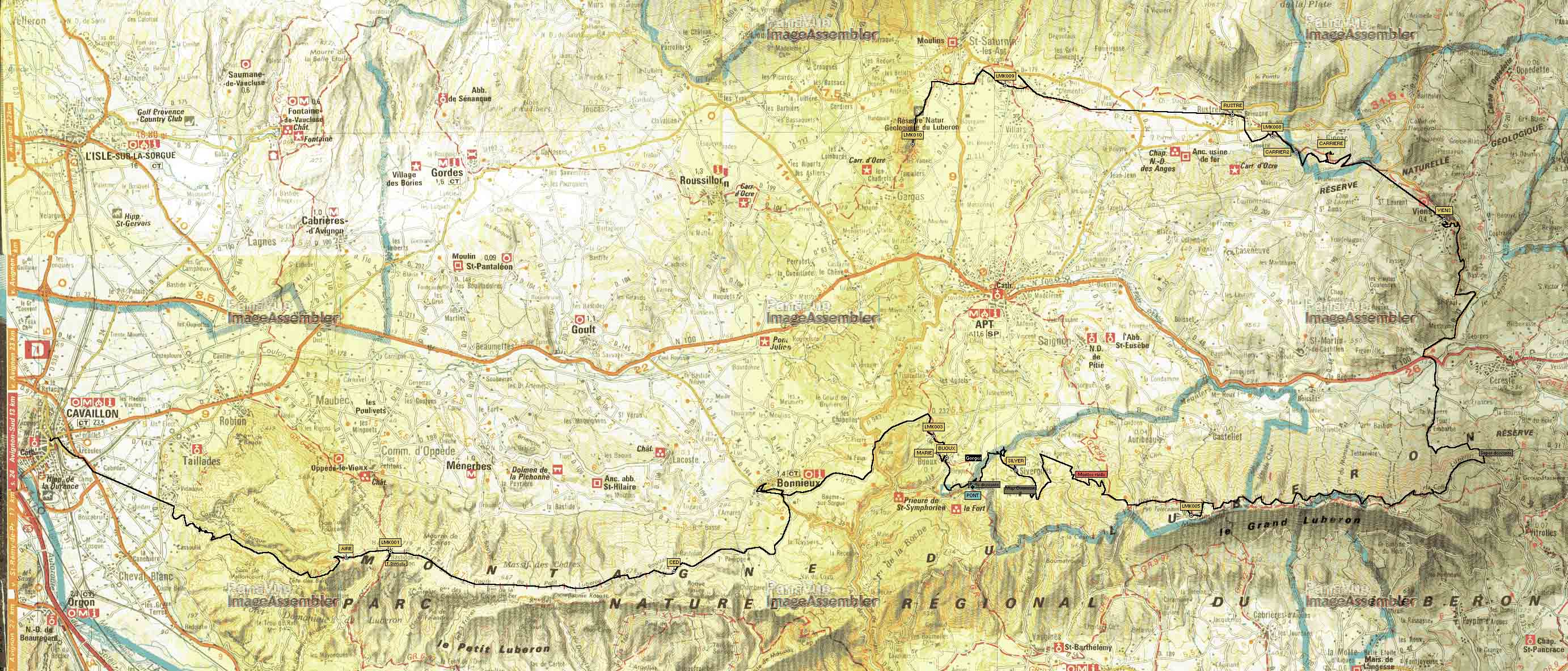
| Luberon Mountains, Provence -
Mountain bike weekend adventure [10-11 Feb 2001] see the track map and the waypoint list |
|
| Prealpes ("Chemins du
soleil") - Mountain bike long weekend [24-28 May 2001] see the track map (956kB) |
|
| Zip file (324kB) with local roads, small villages and lakes in the region of Jablonowo Pomorskie, Ilawa, Ostroda, Olsztyn and Dobre Miasto (3 maps; source 1cm:1km map of the region) | |
| New Hampshire, Mount Monadnock (971m)- 6h winter hiking - from the Parc HQ to the top: MapSource mps file + Ozi waypoints and track | |
| Singletracks in Lynn Woods, MA, - 3h spring MTB (more info about this great MTB spot here): Ozi Explorer track. I used a air photoghraphy downloaded with USAPhotoMaps software from here to learn the terrain before going there. |
Maps in Garmin's .img format
| Garmin's World Map file (346kB) for Katowice (west Poland) with region of Jablonowo Pomorskie, Ilawa, Ostroda (1 map) enriched with local roads, small villages and lakes (source 1cm:1km map of the region) | |
| Garmin's World Map file (342kB) for Warsaw (east Poland) with region of Jablonowo Pomorskie, Ilawa, Ostroda, Olsztyn and Dobre Miasto (3 maps) enriched with local roads, small villages and lakes (source 1cm:1km map of the region) |